PAKISTAN/INDIA
- Canada
- Pakistan/India
- Mauritania
- Ecuador
- Iraq
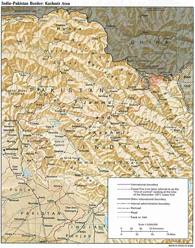
I grouped these two countries as I was shuttling back and forth between them. I was there because the company I worked for was providing the aircraft and aircrew for UNMOGIP (United Nations Military Observer Group India and Pakistan). The UN was based in Rawalpindi but we were living in Islamabad. Our job was to provide transportation for the civilian and military UN personnel to and from the field stations where the military observers were watching the situation in Kashmir. The military personnel's job was to observe the line of control between Pakistan and India and the civilian personnel provided the support functions.
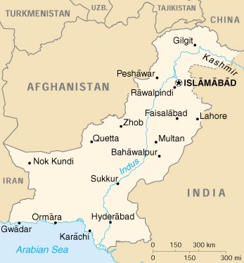
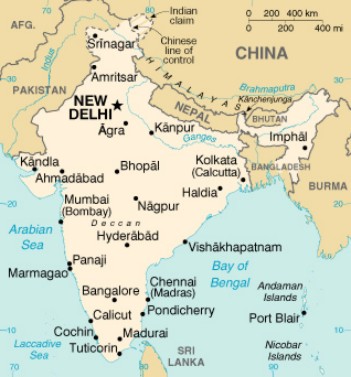
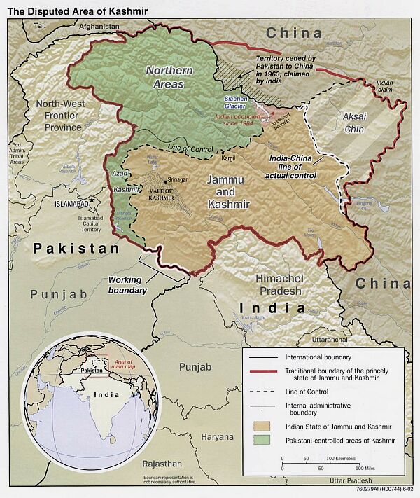
The secondary base was Srinagar. The headquarters would move every six months from Rawalpindi to Srinagar and back. Other than these two destinations we regularly flew to Muzafferabad and Rawalakot on the Pakistani side and Rajouri, Jammu and New Delhi on the Indian side. During the summer we would also fly to Skardu and Gilgit on the Pakistani side, these two stations were in the remote Northern Areas and weren't manned during the winter. The two small maps give you a general layout of the region while the larger map has all the places we flew to in the Kashmir Area on a regular basis. The bottom map gives a better idea of the disputed areas.
 |
 |
|
 |
||
 |
||
 |
We had pretty good accommodations in Islamabad. Over the years there we rented two different places, we were in the house pictured for a few years and the rest of the time we had the upper floor of a nearby house. This place was very nice but was somewhat expensive considering we didn't really need all of it. The place where we rented the upper floor worked out very well for us. It was cheaper than this place and the landlord lived on the ground floor. This meant that he looked after the general maintenance of the house. The downside was the upper floor got very hot in summer with the sun beating down on the unprotected, uninsulated roof. Although it did have fewer bugs/beetles/ants/etc. than this place did. |
| The house pictured above had quite a few "house guests". The coin in the picture is a Canadian one dollar coin (a "loonie") and is there for size comparison, it is roughly 1 inch (25 mm) in diameter. It seemed there was no end of the cockroaches, you could always dust for them and come back to find a bunch of them dead in the middle of the kitchen floor. The interesting thing was that if you left them and didn't pick them up there were these small ants that would eventually come and drag it away. | 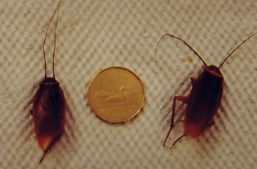 |
We didn't cook at home very often, usually just breakfast. There were a couple of reasons for this, the biggest was that it was so cheap to go out to a restaurant or club that it didn't pay. The other reason was that the kitchen was just too unbearably hot in the summer to want to cook and could get very cold in the winter. There were a lot of good restaurants close to our house and we ate at most of them at one time or another over the years. I was fortunate in that I never got sick from the food there but I know that some of the companies employees had a lot of trouble from eating the food. Since Islamabad was the capital and a lot of foreigners lived there, there are a lot of good places to get food, both restaurants and grocery stores.
| The picture of a Murree butcher shop shows what some of the lower quality shops can look like, this is a butcher shop in Murree. Murree is a town a few hours drive outside of Islamabad, in the hills. During the time the British were in the area it was a popular location since it was much cooler during the summer. Because of this the Brits sent their families there during the summer. | 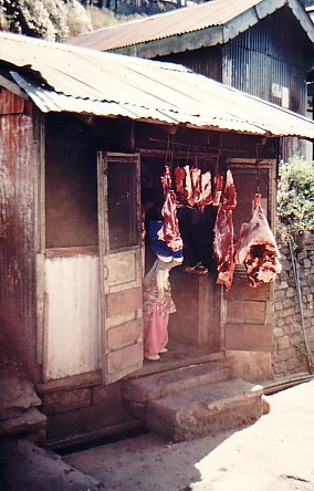 |
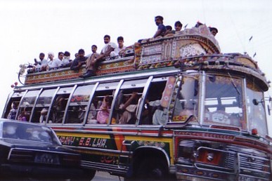 |
Pakistan's public transportation system consists of three different types of "buses". The type pictured here was almost always overloaded. It was cheaper if the passenger road on the outside of the bus. I've seen these buses so full I once counted 16 people hanging off the bars on the back. Another bus style is a large van, you wouldn't see anyone riding on the outside of those but I've seen them so full that it didn't look like it was possible for anyone to move. The last style of "bus" was a small, 3 cylinder, Suzuki truck with a cover on the back. Considering the size of these it was truly amazing the loads they would get in them, I saw one with so many people in the back that the driver was having difficulty steering because the front wheels were only occasionally touching the ground. |
| This is a typical scene during a normal day in most of the cities and towns in the area, This particular city is Peshawar. You can tell by looking at the horse in the foreground that they don't waste a lot of time or effort keeping their work animals in the best condition. | 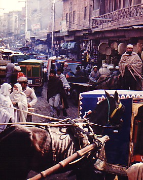 |
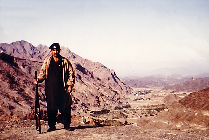 |
On one of my stays in Pakistan a couple of friends and myself decided to take a trip to Peshawar and see the Khyber Pass on one of our weekends off. We flew to Peshawar on Pakistan International Airlines and spent the night at a hotel. Early the next morning we hired a car and driver to take us to the Afghan border, we also had to arrange an armed escort as that was the only way we would be allowed to do the trip. This is a picture of our guard at the Afghan border crossing. |
| This picture was also taken right at the Pakistan/Afghan border. They were still using camels as a means of transport, hence the large pieces of wood it's carrying. This camel was being looked after by a young Afghan boy who didn't want his picture taken. | 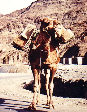 |
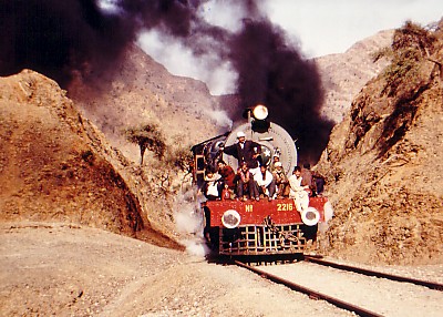 |
I was surprised to see that the Pakistani rail system was still operating steam engines. Unfortunately I don't remember any specific information on this train, just that there were duplicate engines on front and back. Also it was working it's way up the pass and it was working pretty hard to make it up the grade. |
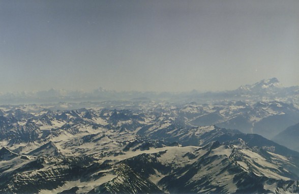
Nanga Parbat is the ninth highest mountain in the world at 26,660' (8,126 m). This isn't the best picture but you can see it sticking it's head above the rest of the mountain range in the far right of the picture above. The only flights that took us close to this were the trips to the Northern stations in Skardu and Gilgit.
| The picture above show what our approach to the airport in Skardu looks like. If you look closely you can just make out the runway in the centre of the picture. This airport is at 7,500' elevation, obviously the surrounding terrain is a lot higher. | 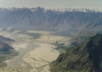 |
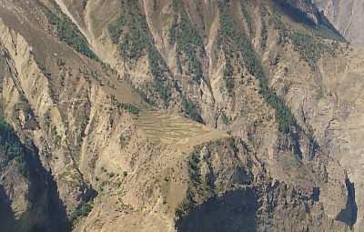 |
Flying around the Himalayas it always amazed me the altitudes at which you would see evidence of people. The small fields in the centre of this picture is at roughly 12,000' halfway between Skardu and Gilgit. There were several places where we could see other evidence of human activity, be it fields like these or small huts for herders. |
| Here is the necessary aircraft picture. This was taken at the Gilgit airport. It was one of the few airports where the guard's let us take pictures, there were only three or four that allowed that. Since the airports are all controlled by the military they don't like photography as you may take a picture of something sensitive. | 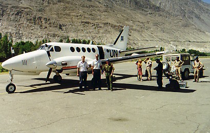 |
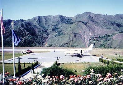 |
This is the Muzafferabad airport. It was one of my favourites. Located in a beautiful valley with a river flowing along parallel to the runway. The airport manager would have us in for tea just about every time we went there. |
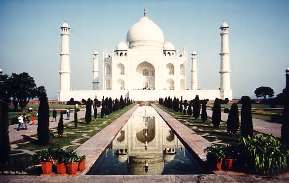
I didn't get very many pictures from India as the vast majority of our time was spent in Pakistan and we would only make it to India when we were working. I did manage to get to Agra, though. Of course I had to get the obligatory shot of the Taj Mahal.
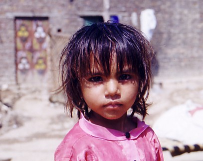
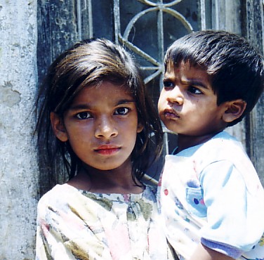
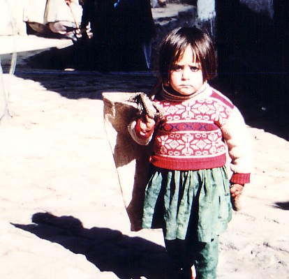
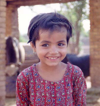
The following pictures I took in various locations. The third little girl was one I saw in Murree and the others were in different Christian ghettos in and near Islamabad, I had a local friend guide me through some of the areas.
This website and all of its
contents (except
where specified)
are Copyright © 2001-2010 by Al Schoepp. All Rights Reserved.